
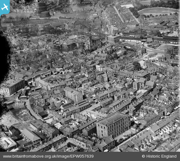
EPW057639 ENGLAND (1938). The town centre, Macclesfield, 1938. This image has been produced from a damaged negative.
© Copyright OpenStreetMap contributors and licensed by the OpenStreetMap Foundation. 2026. Cartography is licensed as CC BY-SA.
Nearby Images (15)
EPW057639

EPW054380

EPW054378

EPW057374

EPW054374

EPW016737

EPW057641

EPW054379

EPW050709
, the Marlborough Mill and the John Clayton Ltd Timber Yard, Macclesfield, 1936. This image has been affected by flare.")
EPW054375

EPW057375

EPW050707
, the Marlborough Mill and the John Clayton Ltd Timber Yard, Macclesfield, 1936")
EPW050706
, the Marlborough Mill and the John Clayton Ltd Timber Yard, Macclesfield, 1936")
EPW050708
, the Marlborough Mill and the John Clayton Ltd Timber Yard, Macclesfield, 1936")
EPW016745

Details
| Title | [EPW057639] The town centre, Macclesfield, 1938. This image has been produced from a damaged negative. |
| Reference | EPW057639 |
| Date | 17-June-1938 |
| Link | |
| Place name | MACCLESFIELD |
| Parish | |
| District | |
| Country | ENGLAND |
| Easting / Northing | 391658, 373576 |
| Longitude / Latitude | -2.1250639395558, 53.258843974528 |
| National Grid Reference | SJ917736 |
Pins

bentenmen |
Friday 6th of June 2014 04:23:19 PM |