
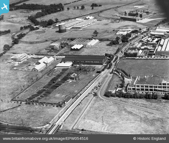
EPW054516 ENGLAND (1937). The Dawnays Limited Engineering Works and surrounding industrial units, Welwyn Garden City, 1937
© Copyright OpenStreetMap contributors and licensed by the OpenStreetMap Foundation. 2026. Cartography is licensed as CC BY-SA.
Nearby Images (29)
EPW054516

EPW054517

EPW054536

EPW022022

EAW052823

EPW054506

EAW052818

EAW052817

EAW052821

EAW052822

EAW052819

EAW052816

EAW052820

EAW053083

EPW054519

EAW053109

EPW022032

EPW054507

EPW014808

EPW062053

EPW014809

EPW014807

EPW054500

EAW053104

EPW025533

EPW047354

EPW047352

EPW054525

EPW062052

Details
| Title | [EPW054516] The Dawnays Limited Engineering Works and surrounding industrial units, Welwyn Garden City, 1937 |
| Reference | EPW054516 |
| Date | 30-July-1937 |
| Link | |
| Place name | WELWYN GARDEN CITY |
| Parish | |
| District | |
| Country | ENGLAND |
| Easting / Northing | 524278, 213098 |
| Longitude / Latitude | -0.19738940576484, 51.802247238727 |
| National Grid Reference | TL243131 |
Pins
Be the first to add a comment to this image!