
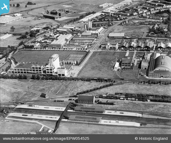
EPW054525 ENGLAND (1937). The Railway Station, the Shredded Wheat Cereal Manufactory and the surrounding industrial area, Welwyn Garden City, 1937
© Copyright OpenStreetMap contributors and licensed by the OpenStreetMap Foundation. 2026. Cartography is licensed as CC BY-SA.
Nearby Images (29)
EPW054525

EPW014807

EPW014809

EAW053104

EPW025533

EPW014808

EPW054507

EPW025374

EAW053109

EPW022032

EPW022021

EPW022031

EPW054515

EAW053083

EPW022033

EPW025535

EPW054535

EPW025532

EPW062053

EPW054519

EPW062055

EPW062054

EPW054511

EPW022022

EPW054500

EPW054527

EAW028157

EAW028155

EPW054516

Details
| Title | [EPW054525] The Railway Station, the Shredded Wheat Cereal Manufactory and the surrounding industrial area, Welwyn Garden City, 1937 |
| Reference | EPW054525 |
| Date | 30-July-1937 |
| Link | |
| Place name | WELWYN GARDEN CITY |
| Parish | |
| District | |
| Country | ENGLAND |
| Easting / Northing | 524152, 212858 |
| Longitude / Latitude | -0.19930197963089, 51.800118209333 |
| National Grid Reference | TL242129 |
Pins

Alan Gowdy |
Friday 3rd of April 2020 05:34:41 PM |
User Comment Contributions
it used to say "Welgar" on Shredded Wheat boxes, before it became part of Nabisco. |
Isleworth1961 |
Wednesday 19th of June 2013 07:13:55 PM |