
EPW022032 ENGLAND (1928). Shredded Wheat Factory and Sectional Factories, Welwyn Garden City, 1928

© Copyright OpenStreetMap contributors and licensed by the OpenStreetMap Foundation. 2026. Cartography is licensed as CC BY-SA.
Nearby Images (28)
EPW022032

EPW062053

EPW054519

EPW014807

EAW053109

EPW054500

EPW014808

EPW014809

EPW054507

EPW054525

EPW054511

EAW053104

EPW047354

EPW047352

EAW053083

EPW025533

EPW022022

EPW054515

EPW054516

EPW054517

EPW025374

EPW054536

EPW022021

EPW022031

EPW025535

EPW054535

EPW022033

EPW025532

Details
| Title | [EPW022032] Shredded Wheat Factory and Sectional Factories, Welwyn Garden City, 1928 |
| Reference | EPW022032 |
| Date | July-1928 |
| Link | |
| Place name | WELWYN GARDEN CITY |
| Parish | |
| District | |
| Country | ENGLAND |
| Easting / Northing | 524268, 212916 |
| Longitude / Latitude | -0.19759962360097, 51.800613719972 |
| National Grid Reference | TL243129 |
Pins
Be the first to add a comment to this image!
User Comment Contributions
This factory was right by the LNER - but I see no sign of the railway. |

Mr |
Wednesday 11th of June 2014 04:33:34 PM |
From my photo taken yesterday you can see that the factory is a short distance away from the railway line. |

Class31 |
Wednesday 11th of June 2014 04:33:34 PM |
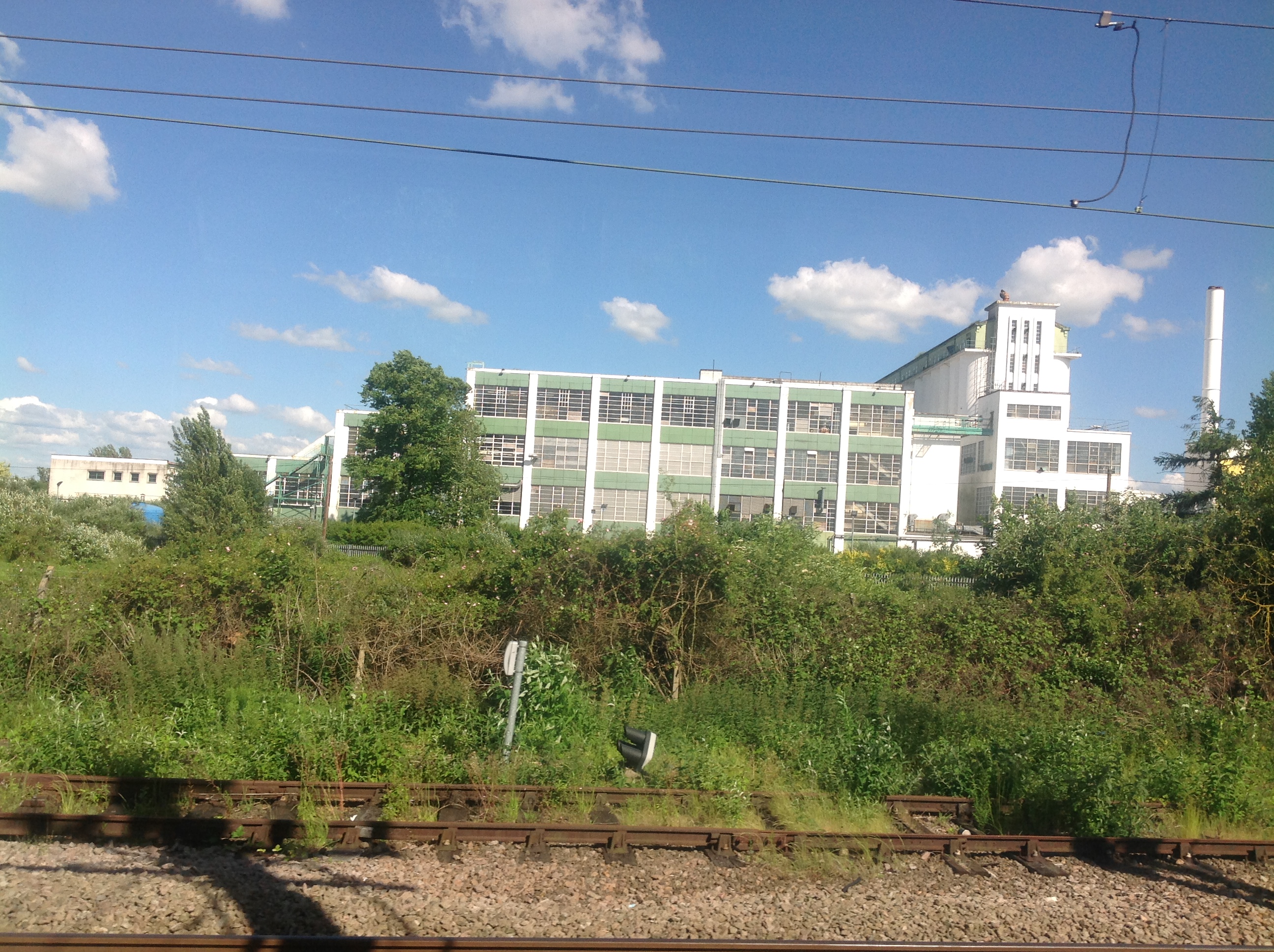
The Shredded Wheat Factory from a train, Welwyn Garden City, 10/06/2014 |
Class31 |
Wednesday 11th of June 2014 04:31:24 PM |