
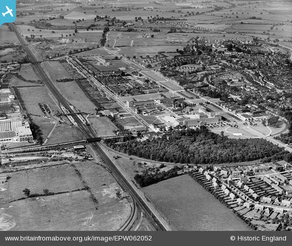
EPW062052 ENGLAND (1939). The town centre, Welwyn Garden City, from the north-east, 1939
© Copyright OpenStreetMap contributors and licensed by the OpenStreetMap Foundation. 2026. Cartography is licensed as CC BY-SA.
Nearby Images (17)
EPW062052

EPW062049

EPW054490

EPW047382

EPW054502

EPW054505

EPW062048

EPW047380

EPW047381

EPW047383

EAW052816

EAW052820

EAW052817

EPW054504

EAW052823

EPW054536

EPW054516

Details
| Title | [EPW062052] The town centre, Welwyn Garden City, from the north-east, 1939 |
| Reference | EPW062052 |
| Date | 28-June-1939 |
| Link | |
| Place name | WELWYN GARDEN CITY |
| Parish | |
| District | |
| Country | ENGLAND |
| Easting / Northing | 524040, 213330 |
| Longitude / Latitude | -0.20075664682904, 51.804385217698 |
| National Grid Reference | TL240133 |
Pins
Be the first to add a comment to this image!