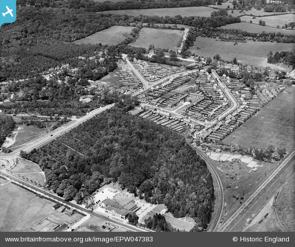
EPW047383 ENGLAND (1935). Digswell Road and environs, Welwyn Garden City, 1935
    © Copyright OpenStreetMap contributors and licensed by the OpenStreetMap Foundation. 2025. Cartography is licensed as CC BY-SA.
  
Nearby Images (14)
Details
| Title | [EPW047383] Digswell Road and environs, Welwyn Garden City, 1935 | 
| Reference | EPW047383 | 
| Date | May-1935 | 
| Link | |
| Place name | WELWYN GARDEN CITY | 
| Parish | |
| District | |
| Country | ENGLAND | 
| Easting / Northing | 523840, 213490 | 
| Longitude / Latitude | -0.20359900043867, 51.805867577008 | 
| National Grid Reference | TL238135 | 
Pins
|  Future Nut Grove. Our back gdn at No.7 backed onto the woods here (Sherrards Wood). |   SueB | Wednesday 22nd of June 2016 11:09:58 PM | 
 
             
  ![[EPW047383] Digswell Road and environs, Welwyn Garden City, 1935](http://britainfromabove.org.uk/sites/all/libraries/aerofilms-images/public/100x100/EPW/047/EPW047383.jpg) 
  
                                          ![[EPW047381] Digswell Road and the Cherry Tree Restaurant, Welwyn Garden City, 1935](http://britainfromabove.org.uk/sites/all/libraries/aerofilms-images/public/100x100/EPW/047/EPW047381.jpg) 
 ![[EPW047380] Digswell Junction and the Cherry Tree Restaurant, Welwyn Garden City, 1935](http://britainfromabove.org.uk/sites/all/libraries/aerofilms-images/public/100x100/EPW/047/EPW047380.jpg) 
 ![[EPW062048] Digswell Road and environs, Welwyn Garden City, 1939](http://britainfromabove.org.uk/sites/all/libraries/aerofilms-images/public/100x100/EPW/062/EPW062048.jpg) 
 ![[EPW054490] Digswell Railway Junction, housing surrounding Walden Road and The Campus, Sherrardspark, 1937](http://britainfromabove.org.uk/sites/all/libraries/aerofilms-images/public/100x100/EPW/054/EPW054490.jpg) 
 ![[EPW054504] The residential area surrounding Walden Place, Sherrardspark, 1937](http://britainfromabove.org.uk/sites/all/libraries/aerofilms-images/public/100x100/EPW/054/EPW054504.jpg) 
 ![[EPW062049] Digswell Road and environs, Welwyn Garden City, 1939](http://britainfromabove.org.uk/sites/all/libraries/aerofilms-images/public/100x100/EPW/062/EPW062049.jpg) 
 ![[EPW047382] Digswell Junction and the Cherry Tree Restaurant, Welwyn Garden City, 1935](http://britainfromabove.org.uk/sites/all/libraries/aerofilms-images/public/100x100/EPW/047/EPW047382.jpg) 
 ![[EPW047359] Housing around Walden Place, Welwyn Garden City, 1935](http://britainfromabove.org.uk/sites/all/libraries/aerofilms-images/public/100x100/EPW/047/EPW047359.jpg) 
 ![[EPW047358] Sherrardspark Wood and housing around Walden Place, Welwyn Garden City, 1935](http://britainfromabove.org.uk/sites/all/libraries/aerofilms-images/public/100x100/EPW/047/EPW047358.jpg) 
 ![[EPW047360] Housing around Walden Place and environs, Welwyn Garden City, 1935](http://britainfromabove.org.uk/sites/all/libraries/aerofilms-images/public/100x100/EPW/047/EPW047360.jpg) 
 ![[EPW054491] Lyles Bridge, Digswell Lodge Farm and the residential area surrounding Blakemere Road, Sherrardspark, 1937](http://britainfromabove.org.uk/sites/all/libraries/aerofilms-images/public/100x100/EPW/054/EPW054491.jpg) 
 ![[EPW062052] The town centre, Welwyn Garden City, from the north-east, 1939](http://britainfromabove.org.uk/sites/all/libraries/aerofilms-images/public/100x100/EPW/062/EPW062052.jpg) 
 ![[EPW062050] The town centre, Welwyn Garden City, from the north-west, 1939](http://britainfromabove.org.uk/sites/all/libraries/aerofilms-images/public/100x100/EPW/062/EPW062050.jpg)