
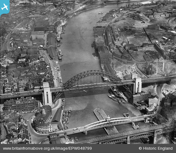
EPW048799 ENGLAND (1935). The Tyne Bridge, Newcastle Swing Bridge and environs, Newcastle Upon Tyne, 1935
© Copyright OpenStreetMap contributors and licensed by the OpenStreetMap Foundation. 2026. Cartography is licensed as CC BY-SA.
Nearby Images (27)
EPW048799

EPW025015

EPW048805

EPW048263

EPW020569

EPW020570

EPW048345

EPW025016

EPW054561

EPW019820

EPW020568

EPW048803

EPW048229

EPW054559

EPW048346

EPW048235

EPW051090

EPW048230

EPW019832

EPW051088

EPW010393

EPW048800

EPW048801

EPW010383

EAW405203

EAW017459

EAW600907

Details
| Title | [EPW048799] The Tyne Bridge, Newcastle Swing Bridge and environs, Newcastle Upon Tyne, 1935 |
| Reference | EPW048799 |
| Date | August-1935 |
| Link | |
| Place name | NEWCASTLE UPON TYNE |
| Parish | |
| District | |
| Country | ENGLAND |
| Easting / Northing | 425399, 563825 |
| Longitude / Latitude | -1.6032184539918, 54.968323314567 |
| National Grid Reference | NZ254638 |
Pins

John Wass |
Sunday 27th of October 2019 02:44:19 PM | |
|
Chells809 |
Friday 8th of September 2017 10:00:11 PM | |
|
MB |
Friday 18th of April 2014 05:47:59 PM | |
|
MB |
Friday 18th of April 2014 05:44:51 PM | |
|
MB |
Friday 18th of April 2014 05:42:56 PM | |

Dylan Moore |
Sunday 5th of May 2013 09:35:56 PM |
User Comment Contributions
From the NewcastleGateshead online guide: 'The Tyne Bridge was designed by the engineering firm Mott, Hay and Anderson [forerunner of today's MottMacDonald]and was built by Dorman Long and Co. of Middlesbrough who later went on to build Sydney Harbour Bridge, which opened three years later in 1932.' |
MB |
Friday 18th of April 2014 05:47:08 PM |
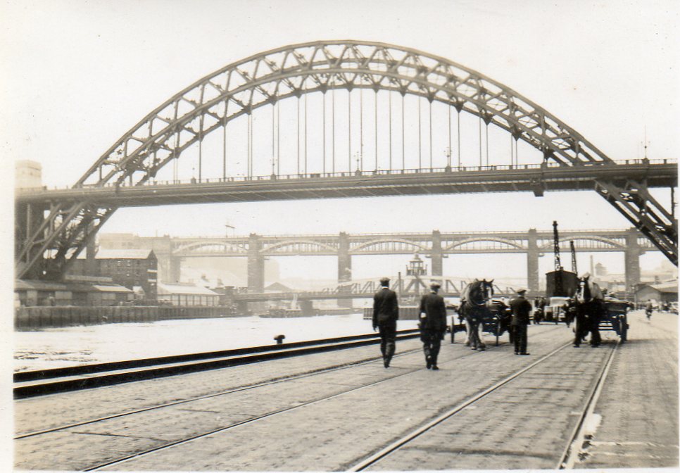
Snapshot taken from Quayside June or July 1939 |

Class31 |
Monday 7th of April 2014 03:57:21 PM |
View looking east. |
Class31 |
Monday 7th of April 2014 03:56:04 PM |