
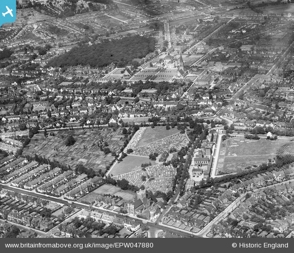
EPW047880 ENGLAND (1935). Hoop Lane Jewish Cemetery and environs, Golders Green, 1935
© Copyright OpenStreetMap contributors and licensed by the OpenStreetMap Foundation. 2025. Cartography is licensed as CC BY-SA.
Nearby Images (15)
EPW047880

EPW028985

EPW028172

EPW047875

EPW028984

EPW028186

EPW028986

EPW047876

EPW028187

EPW047874

EPW047873

EPW028977

EPW028173

EAW046479

EPW047877

Details
| Title | [EPW047880] Hoop Lane Jewish Cemetery and environs, Golders Green, 1935 |
| Reference | EPW047880 |
| Date | June-1935 |
| Link | |
| Place name | GOLDERS GREEN |
| Parish | |
| District | |
| Country | ENGLAND |
| Easting / Northing | 525300, 188225 |
| Longitude / Latitude | -0.19150724959933, 51.578467828676 |
| National Grid Reference | TQ253882 |
Pins
Be the first to add a comment to this image!