
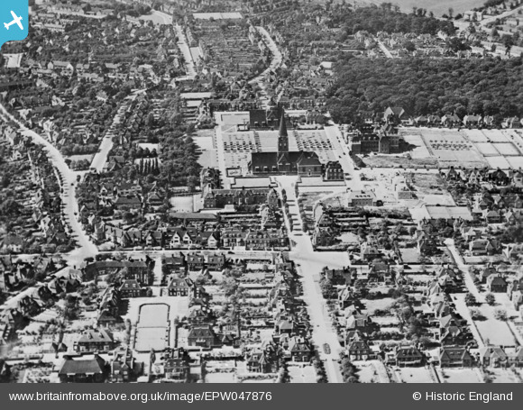
EPW047876 ENGLAND (1935). Central Square and Southway, Hampstead Garden Suburb, 1935. This image has been produced from a copy-negative.
© Copyright OpenStreetMap contributors and licensed by the OpenStreetMap Foundation. 2025. Cartography is licensed as CC BY-SA.
Nearby Images (14)
EPW047876

EPW028986

EPW028984

EPW009091

EPW028172

EPW028985

EPW028173

EPW028977

EAW046479

EPW028983

EPW047877

EPW047874

EPW028175

EPW047880

Details
| Title | [EPW047876] Central Square and Southway, Hampstead Garden Suburb, 1935. This image has been produced from a copy-negative. |
| Reference | EPW047876 |
| Date | June-1935 |
| Link | |
| Place name | HAMPSTEAD GARDEN SUBURB |
| Parish | |
| District | |
| Country | ENGLAND |
| Easting / Northing | 525527, 188290 |
| Longitude / Latitude | -0.18820941399581, 51.579001524855 |
| National Grid Reference | TQ255883 |
Pins
Be the first to add a comment to this image!