
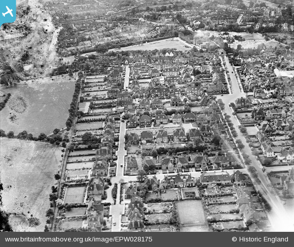
EPW028175 ENGLAND (1929). Turner Drive and environs, Hampstead Garden Suburb, 1929
© Copyright OpenStreetMap contributors and licensed by the OpenStreetMap Foundation. 2025. Cartography is licensed as CC BY-SA.
Nearby Images (8)
EPW028175

EPW028983

EPW028172

EPW028984

EPW047876

EPW028985

EPW009091

EPW028986

Details
| Title | [EPW028175] Turner Drive and environs, Hampstead Garden Suburb, 1929 |
| Reference | EPW028175 |
| Date | July-1929 |
| Link | |
| Place name | HAMPSTEAD GARDEN SUBURB |
| Parish | |
| District | |
| Country | ENGLAND |
| Easting / Northing | 525721, 188157 |
| Longitude / Latitude | -0.18545845118976, 51.577762891861 |
| National Grid Reference | TQ257882 |
Pins
Be the first to add a comment to this image!