
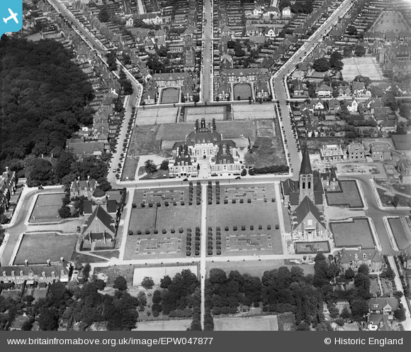
EPW047877 ENGLAND (1935). The Institute, Hampstead Garden Suburb, 1935
© Copyright OpenStreetMap contributors and licensed by the OpenStreetMap Foundation. 2025. Cartography is licensed as CC BY-SA.
Nearby Images (10)
EPW047877

EAW046479

EPW028173

EPW028977

EPW009091

EPW047874

EPW028986

EPW047876

EPW028984

EPW047880

Details
| Title | [EPW047877] The Institute, Hampstead Garden Suburb, 1935 |
| Reference | EPW047877 |
| Date | June-1935 |
| Link | |
| Place name | HAMPSTEAD GARDEN SUBURB |
| Parish | |
| District | |
| Country | ENGLAND |
| Easting / Northing | 525548, 188456 |
| Longitude / Latitude | -0.18784711517777, 51.580488835382 |
| National Grid Reference | TQ255885 |
Pins
Be the first to add a comment to this image!