
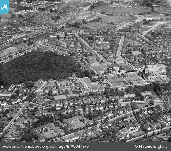
EPW047875 ENGLAND (1935). Central Square and the view up Southway, Hampstead Garden Suburb, from the west, 1935
© Copyright OpenStreetMap contributors and licensed by the OpenStreetMap Foundation. 2025. Cartography is licensed as CC BY-SA.
Nearby Images (7)
EPW047875

EPW047873

EPW047874

EPW028977

EAW046479

EPW047880

EPW028173

Details
| Title | [EPW047875] Central Square and the view up Southway, Hampstead Garden Suburb, from the west, 1935 |
| Reference | EPW047875 |
| Date | June-1935 |
| Link | |
| Place name | HAMPSTEAD GARDEN SUBURB |
| Parish | |
| District | |
| Country | ENGLAND |
| Easting / Northing | 525269, 188448 |
| Longitude / Latitude | -0.19187487912383, 51.580479022757 |
| National Grid Reference | TQ253884 |
Pins

michaelxsteiner@aol.com |
Monday 11th of October 2021 06:23:28 PM |