
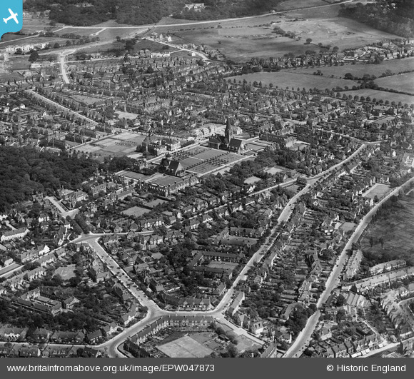
EPW047873 ENGLAND (1935). Central Square and environs, Hampstead Garden Suburb, from the west, 1935
© Copyright OpenStreetMap contributors and licensed by the OpenStreetMap Foundation. 2025. Cartography is licensed as CC BY-SA.
Nearby Images (5)
EPW047873

EPW047875

EPW047874

EPW028977

EPW047880

Details
| Title | [EPW047873] Central Square and environs, Hampstead Garden Suburb, from the west, 1935 |
| Reference | EPW047873 |
| Date | June-1935 |
| Link | |
| Place name | HAMPSTEAD GARDEN SUBURB |
| Parish | |
| District | |
| Country | ENGLAND |
| Easting / Northing | 525230, 188463 |
| Longitude / Latitude | -0.19243215070501, 51.580622509638 |
| National Grid Reference | TQ252885 |
Pins
Be the first to add a comment to this image!