
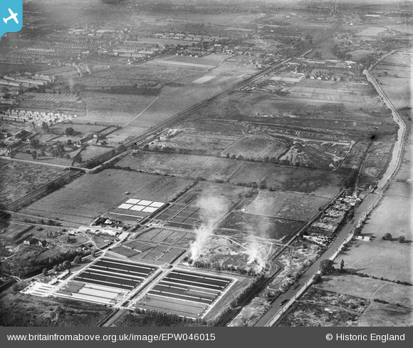
EPW046015 ENGLAND (1934). Edmonton Urban District Council Sewage Farm, Edmonton, from the south-east, 1934
© Copyright OpenStreetMap contributors and licensed by the OpenStreetMap Foundation. 2026. Cartography is licensed as CC BY-SA.
Nearby Images (15)
EPW046015

EPW046021

EPW048903

EPW046018

EPW046014

EPW049720

EPW049531

EPW049699

EPW046020

EPW046019

EPW049707

EPW046016

EPW049721

EPW049526

EPW046446

Details
| Title | [EPW046015] Edmonton Urban District Council Sewage Farm, Edmonton, from the south-east, 1934 |
| Reference | EPW046015 |
| Date | September-1934 |
| Link | |
| Place name | EDMONTON |
| Parish | |
| District | |
| Country | ENGLAND |
| Easting / Northing | 535958, 193436 |
| Longitude / Latitude | -0.03575029365332, 51.62282912836 |
| National Grid Reference | TQ360934 |
