
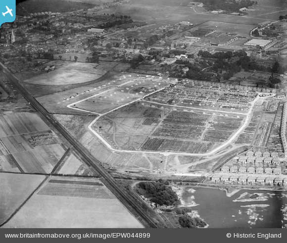
EPW044899 ENGLAND (1934). Construction of the Grosvenor Park Estate and environs, Feltham, 1934
© Copyright OpenStreetMap contributors and licensed by the OpenStreetMap Foundation. 2026. Cartography is licensed as CC BY-SA.
Nearby Images (25)
EPW044899

EPW044896

EPW060358

EPW044900

EPW044520

EPR000006

EPR000009

EPR000002

EPR000004

EPR000003

EPW044898

EPW044549

EPW044897

EPR000005

EPR000007

EPR000008

EPW044354

EPW044551

EPW044547

EPW044548

EPW044550

EPW044353

EPW044895

EPR000090

EPR000010

Details
| Title | [EPW044899] Construction of the Grosvenor Park Estate and environs, Feltham, 1934 |
| Reference | EPW044899 |
| Date | June-1934 |
| Link | |
| Place name | FELTHAM |
| Parish | |
| District | |
| Country | ENGLAND |
| Easting / Northing | 509978, 172874 |
| Longitude / Latitude | -0.41734667696867, 51.443675631217 |
| National Grid Reference | TQ100729 |
Pins
Be the first to add a comment to this image!