
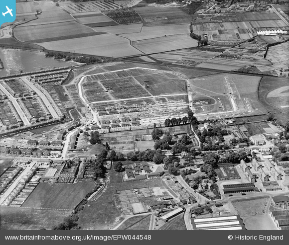
EPW044548 ENGLAND (1934). The Grosvenor Park estate under construction, Feltham, 1934
© Copyright OpenStreetMap contributors and licensed by the OpenStreetMap Foundation. 2026. Cartography is licensed as CC BY-SA.
Nearby Images (24)
EPW044548

EPW044547

EPW044551

EPW044550

EPR000090

EPR000004

EPR000010

EPW044549

EPW044895

EPR000009

EPW044520

EPR000002

EPR000142

EPW044900

EPR000143

EPW060358

EPR000007

EPW044897

EPR000141

EPR000147

EPW044899

EPW044353

EPW044896

EPR000006

Details
| Title | [EPW044548] The Grosvenor Park estate under construction, Feltham, 1934 |
| Reference | EPW044548 |
| Date | May-1934 |
| Link | |
| Place name | FELTHAM |
| Parish | |
| District | |
| Country | ENGLAND |
| Easting / Northing | 510144, 172723 |
| Longitude / Latitude | -0.41500581296211, 51.4422860044 |
| National Grid Reference | TQ101727 |
