
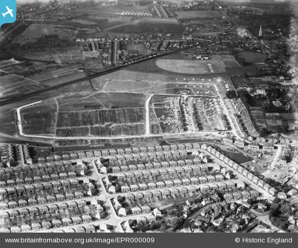
EPR000009 ENGLAND (1934). Housing estate under construction surrounding Grosvenor Park, Feltham, 1934
© Copyright OpenStreetMap contributors and licensed by the OpenStreetMap Foundation. 2026. Cartography is licensed as CC BY-SA.
Nearby Images (30)
EPR000009

EPR000002

EPW044549

EPW044897

EPR000007

EPW044520

EPW044895

EPW044550

EPW044900

EPR000004

EPW044547

EPW044548

EPW044899

EPW060358

EPW044353

EPW044898

EPW044551

EPW044896

EPW044354

EPR000008

EPR000010

EPR000090

EPR000003

EPR000142

EPR000143

EPR000147

EPR000006

EPR000005

EPW044355

EPR000141

Details
| Title | [EPR000009] Housing estate under construction surrounding Grosvenor Park, Feltham, 1934 |
| Reference | EPR000009 |
| Date | May-1934 |
| Link | |
| Place name | FELTHAM |
| Parish | |
| District | |
| Country | ENGLAND |
| Easting / Northing | 510013, 172740 |
| Longitude / Latitude | -0.41688487029428, 51.44246428514 |
| National Grid Reference | TQ100727 |
Pins
Be the first to add a comment to this image!