
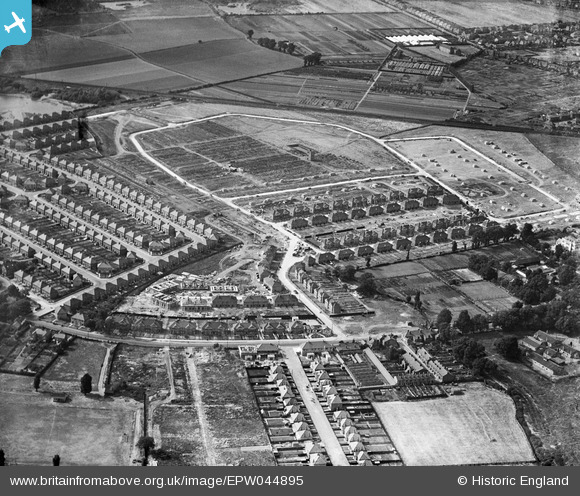
EPW044895 ENGLAND (1934). Construction of the Grosvenor Park Estate and environs, Feltham, 1934
© Copyright OpenStreetMap contributors and licensed by the OpenStreetMap Foundation. 2026. Cartography is licensed as CC BY-SA.
Nearby Images (25)
EPW044895

EPW044550

EPW044549

EPW044547

EPW044548

EPR000142

EPR000143

EPR000009

EPR000002

EPR000010

EPR000147

EPR000007

EPW044897

EPR000090

EPW044353

EPW044551

EPR000004

EPR000141

EPW044520

EPW044900

EPW060358

EPW044899

EPW044898

EPW044896

EPR000003

Details
| Title | [EPW044895] Construction of the Grosvenor Park Estate and environs, Feltham, 1934 |
| Reference | EPW044895 |
| Date | June-1934 |
| Link | |
| Place name | FELTHAM |
| Parish | |
| District | |
| Country | ENGLAND |
| Easting / Northing | 510074, 172637 |
| Longitude / Latitude | -0.41603946240105, 51.44152654796 |
| National Grid Reference | TQ101726 |
