
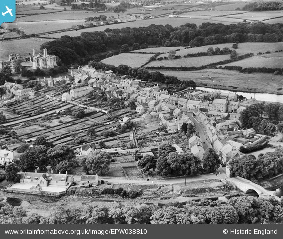
EPW038810 ENGLAND (1932). The village, Warkworth, 1932
© Copyright OpenStreetMap contributors and licensed by the OpenStreetMap Foundation. 2025. Cartography is licensed as CC BY-SA.
Nearby Images (8)
EPW038810

EAW041298

EAW006066

EAW041299

EPW038813

EAW006063

EPW038812

EAW008924

Details
| Title | [EPW038810] The village, Warkworth, 1932 |
| Reference | EPW038810 |
| Date | June-1932 |
| Link | |
| Place name | WARKWORTH |
| Parish | WARKWORTH |
| District | |
| Country | ENGLAND |
| Easting / Northing | 424749, 606033 |
| Longitude / Latitude | -1.6096859282773, 55.347669973659 |
| National Grid Reference | NU247060 |
Pins

melgibbs |
Wednesday 10th of December 2014 11:31:43 AM | |
|
melgibbs |
Wednesday 10th of December 2014 11:30:15 AM |