
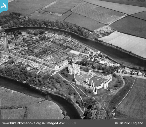
EAW006063 ENGLAND (1947). Warkworth Castle and village, Warkworth, 1947
© Copyright OpenStreetMap contributors and licensed by the OpenStreetMap Foundation. 2026. Cartography is licensed as CC BY-SA.
Nearby Images (16)
EAW006063

EAW041299

EAW008922

EAW006062

EAW008924

EPW038814

EAW006066

EAW006064

EAW006065

EAW008923

EPW038808

EAW006067

EAW008920

EAW008921

EAW041298

EPW038810

Details
| Title | [EAW006063] Warkworth Castle and village, Warkworth, 1947 |
| Reference | EAW006063 |
| Date | 21-May-1947 |
| Link | |
| Place name | WARKWORTH |
| Parish | WARKWORTH |
| District | |
| Country | ENGLAND |
| Easting / Northing | 424789, 605868 |
| Longitude / Latitude | -1.6090697137461, 55.346185185614 |
| National Grid Reference | NU248059 |

