
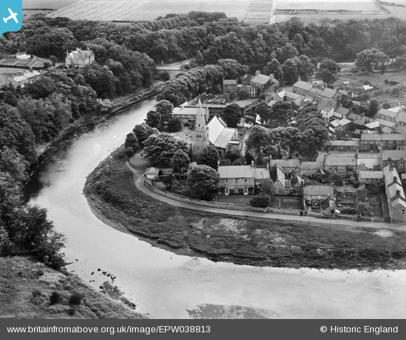
EPW038813 ENGLAND (1932). St Lawrence's Church and environs, Warkworth, 1932
© Copyright OpenStreetMap contributors and licensed by the OpenStreetMap Foundation. 2025. Cartography is licensed as CC BY-SA.
Nearby Images (5)
EPW038813

EPW038812

EPW038810

EAW041298

EAW006066

Details
| Title | [EPW038813] St Lawrence's Church and environs, Warkworth, 1932 |
| Reference | EPW038813 |
| Date | June-1932 |
| Link | |
| Place name | WARKWORTH |
| Parish | WARKWORTH |
| District | |
| Country | ENGLAND |
| Easting / Northing | 424671, 606169 |
| Longitude / Latitude | -1.6109040450086, 55.348896059153 |
| National Grid Reference | NU247062 |
Pins

melgibbs |
Wednesday 10th of December 2014 11:27:38 AM | |
|
melgibbs |
Friday 27th of December 2013 10:10:13 AM |