
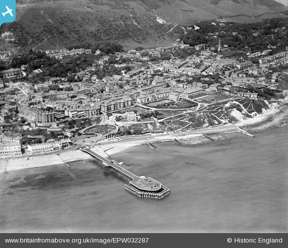
EPW032287 ENGLAND (1930). The Royal Victoria Pier, the town centre and St Boniface Down, Ventnor, 1930
© Copyright OpenStreetMap contributors and licensed by the OpenStreetMap Foundation. 2026. Cartography is licensed as CC BY-SA.
Nearby Images (20)
EPW032287

EAW038593

EPW032285

EPW023099

EPW032286

EAW015243

EPW039656

EPW043010

EPW023097

EAW038594

EPW023096

EPW000502

EPW043014

EAW022210

EAW015242

EAW038592

EPW022978

EPW022982

EAW022208

EAW022209

Details
| Title | [EPW032287] The Royal Victoria Pier, the town centre and St Boniface Down, Ventnor, 1930 |
| Reference | EPW032287 |
| Date | June-1930 |
| Link | |
| Place name | VENTNOR |
| Parish | VENTNOR |
| District | |
| Country | ENGLAND |
| Easting / Northing | 456450, 77387 |
| Longitude / Latitude | -1.2023979576834, 50.592890352802 |
| National Grid Reference | SZ565774 |
Pins
Be the first to add a comment to this image!