
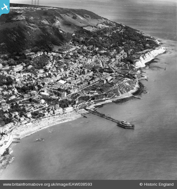
EAW038593 ENGLAND (1951). Royal Victoria Pier and the town, Ventnor, 1951. This image has been produced from a print.
© Copyright OpenStreetMap contributors and licensed by the OpenStreetMap Foundation. 2026. Cartography is licensed as CC BY-SA.
Nearby Images (21)
EAW038593

EPW032287

EPW032285

EPW023099

EPW032286

EPW043010

EAW015243

EPW039656

EPW043014

EAW015242

EAW038594

EPW022978

EPW022982

EPW023097

EAW038592

EPW023096

EAW022210

EPW022979

EAW022209

EPW000502

EAW022207

Details
| Title | [EAW038593] Royal Victoria Pier and the town, Ventnor, 1951. This image has been produced from a print. |
| Reference | EAW038593 |
| Date | 13-August-1951 |
| Link | |
| Place name | VENTNOR |
| Parish | VENTNOR |
| District | |
| Country | ENGLAND |
| Easting / Northing | 456420, 77420 |
| Longitude / Latitude | -1.2028167822342, 50.593190024201 |
| National Grid Reference | SZ564774 |
Pins
Be the first to add a comment to this image!