
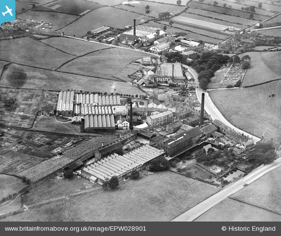
EPW028901 ENGLAND (1929). Cape, Broom and Bank Bottom Woollen Mills and Springfield Worsted Mill, Farsley Beck Bottom, 1929
© Copyright OpenStreetMap contributors and licensed by the OpenStreetMap Foundation. 2026. Cartography is licensed as CC BY-SA.
Nearby Images (14)
EPW028901

EPW028899

EPW028896

EPW028898

EPW028900

EPW028897

EPW055890

EPW028895

EPW028892

EPW028893

EPW028891

EPW028894

EPW028889

EPW028890

Details
| Title | [EPW028901] Cape, Broom and Bank Bottom Woollen Mills and Springfield Worsted Mill, Farsley Beck Bottom, 1929 |
| Reference | EPW028901 |
| Date | August-1929 |
| Link | |
| Place name | FARSLEY BECK BOTTOM |
| Parish | |
| District | |
| Country | ENGLAND |
| Easting / Northing | 422347, 435440 |
| Longitude / Latitude | -1.6605556998866, 53.814549916008 |
| National Grid Reference | SE223354 |
Pins

farsleyflyer |
Saturday 20th of October 2012 11:30:27 PM | |
|
farsleyflyer |
Saturday 20th of October 2012 11:29:41 PM | |
|
farsleyflyer |
Saturday 20th of October 2012 09:27:47 AM | |
|
farsleyflyer |
Saturday 20th of October 2012 09:27:15 AM | |
|
farsleyflyer |
Saturday 20th of October 2012 09:26:28 AM |