
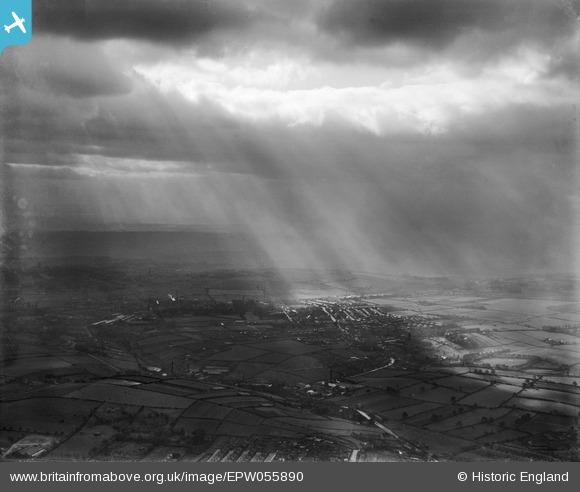
EPW055890 ENGLAND (1937). Sunlight breaking over Farsley, Farsley Beck Bottom, from the north-east, 1937
© Copyright OpenStreetMap contributors and licensed by the OpenStreetMap Foundation. 2026. Cartography is licensed as CC BY-SA.
Nearby Images (10)
EPW055890

EPW028891

EPW028892

EPW028894

EPW028895

EPW028893

EPW028889

EPW028890

EPW028901

EPW028896

Details
| Title | [EPW055890] Sunlight breaking over Farsley, Farsley Beck Bottom, from the north-east, 1937 |
| Reference | EPW055890 |
| Date | 24-October-1937 |
| Link | |
| Place name | FARSLEY BECK BOTTOM |
| Parish | |
| District | |
| Country | ENGLAND |
| Easting / Northing | 422265, 435680 |
| Longitude / Latitude | -1.6617838628926, 53.816710753223 |
| National Grid Reference | SE223357 |
Pins

djb |
Wednesday 1st of April 2015 09:19:04 PM | |
|
djb |
Wednesday 1st of April 2015 09:16:15 PM | |

Class31 |
Wednesday 12th of June 2013 09:27:39 PM | |
|
Class31 |
Wednesday 12th of June 2013 09:26:35 PM | |
|
Class31 |
Wednesday 12th of June 2013 09:25:28 PM | |
|
Class31 |
Wednesday 12th of June 2013 09:24:28 PM | |
|
Class31 |
Wednesday 12th of June 2013 09:23:07 PM | |
|
Class31 |
Wednesday 12th of June 2013 09:20:06 PM | |
|
Class31 |
Wednesday 12th of June 2013 09:18:42 PM |
User Comment Contributions
View looking south over Farsley Beck Bottom |
Class31 |
Tuesday 2nd of July 2013 05:30:42 PM |
What a tricky one. We'll update the catalogue and post the new record here in due course. Yours, Katy Britain from Above Cataloguing Team Leader |
Katy Whitaker |
Tuesday 2nd of July 2013 05:30:42 PM |