
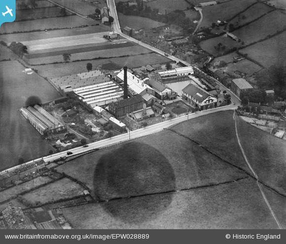
EPW028889 ENGLAND (1929). Springfield Worsted Mill and Bagley Lane, Farsley Beck Bottom, 1929
© Copyright OpenStreetMap contributors and licensed by the OpenStreetMap Foundation. 2026. Cartography is licensed as CC BY-SA.
Nearby Images (11)
EPW028889

EPW028890

EPW028893

EPW028895

EPW028894

EPW028892

EPW028891

EPW055890

EPW028896

EPW028901

EPW028899

Details
| Title | [EPW028889] Springfield Worsted Mill and Bagley Lane, Farsley Beck Bottom, 1929 |
| Reference | EPW028889 |
| Date | August-1929 |
| Link | |
| Place name | FARSLEY BECK BOTTOM |
| Parish | |
| District | |
| Country | ENGLAND |
| Easting / Northing | 422127, 435647 |
| Longitude / Latitude | -1.6638824834259, 53.816420013729 |
| National Grid Reference | SE221356 |
Pins
Be the first to add a comment to this image!