
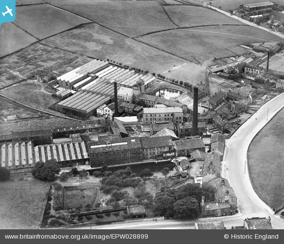
EPW028899 ENGLAND (1929). Broom Woollen Mill and Cape Woollen Mill, Farsley Beck Bottom, 1929
© Copyright OpenStreetMap contributors and licensed by the OpenStreetMap Foundation. 2026. Cartography is licensed as CC BY-SA.
Nearby Images (12)
EPW028899

EPW028901

EPW028898

EPW028896

EPW028900

EPW028897

EPW028895

EPW028892

EPW028893

EPW028894

EPW028889

EPW028890

Details
| Title | [EPW028899] Broom Woollen Mill and Cape Woollen Mill, Farsley Beck Bottom, 1929 |
| Reference | EPW028899 |
| Date | August-1929 |
| Link | |
| Place name | FARSLEY BECK BOTTOM |
| Parish | |
| District | |
| Country | ENGLAND |
| Easting / Northing | 422360, 435427 |
| Longitude / Latitude | -1.6603591823187, 53.814432502286 |
| National Grid Reference | SE224354 |
Pins

djb |
Saturday 22nd of June 2013 10:37:32 PM | |
|
farsleyflyer |
Saturday 20th of October 2012 09:23:29 AM | |
|
farsleyflyer |
Saturday 20th of October 2012 09:22:14 AM | |
|
farsleyflyer |
Saturday 20th of October 2012 08:59:30 AM | |
|
farsleyflyer |
Saturday 20th of October 2012 08:58:56 AM |
User Comment Contributions
hi can anyone tell me about the building on the very corner of half mile lane leading on to coal hill lane? is it part of a mill? if so which one? i live in this house at the moment its very beautiful and very big. and is their any other information that can be shared about when it was built etc? thanks |
saralou |
Sunday 20th of January 2013 06:30:16 PM |