
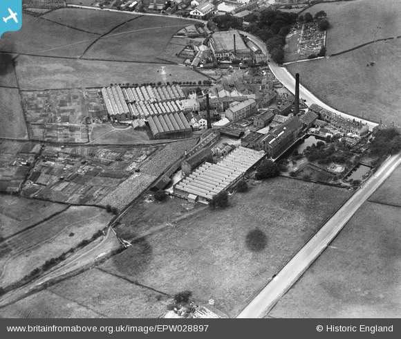
EPW028897 ENGLAND (1929). Broom Woollen Mill and Cape Woollen Mill, Farsley Beck Bottom, 1929
© Copyright OpenStreetMap contributors and licensed by the OpenStreetMap Foundation. 2026. Cartography is licensed as CC BY-SA.
Nearby Images (6)
EPW028897

EPW028900

EPW028898

EPW028899

EPW028901

EPW028896

Details
| Title | [EPW028897] Broom Woollen Mill and Cape Woollen Mill, Farsley Beck Bottom, 1929 |
| Reference | EPW028897 |
| Date | August-1929 |
| Link | |
| Place name | FARSLEY BECK BOTTOM |
| Parish | |
| District | |
| Country | ENGLAND |
| Easting / Northing | 422395, 435343 |
| Longitude / Latitude | -1.6598336684638, 53.813675934118 |
| National Grid Reference | SE224353 |
Pins
Be the first to add a comment to this image!