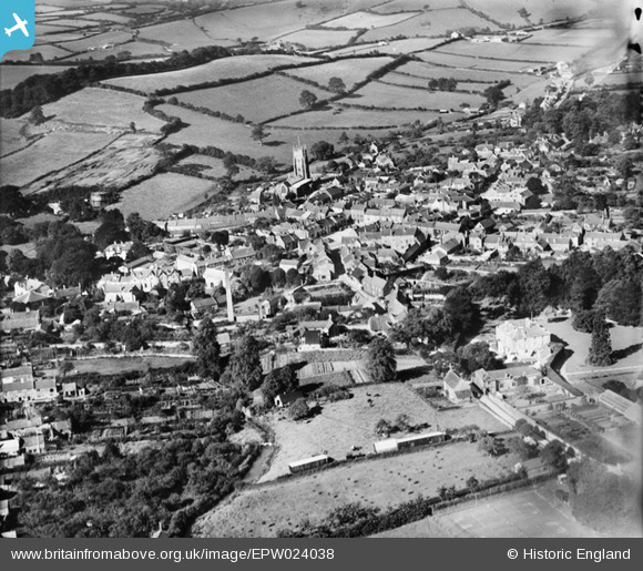
EPW024038 ENGLAND (1928). The town centre, Beaminster, 1928
© Copyright OpenStreetMap contributors and licensed by the OpenStreetMap Foundation. 2025. Cartography is licensed as CC BY-SA.
Nearby Images (17)
EPW024038

EPW024031

EPW013514

EPW024036

EPW054802

EPW013512

EPW013513

EPW054803

EPW024033

EPW054801

EPW054799

EPW054796

EPW054800

EPW054798

EPW024039

EPW024035

EPW024034

Details
| Title | [EPW024038] The town centre, Beaminster, 1928 |
| Reference | EPW024038 |
| Date | September-1928 |
| Link | |
| Place name | BEAMINSTER |
| Parish | BEAMINSTER |
| District | |
| Country | ENGLAND |
| Easting / Northing | 348065, 101357 |
| Longitude / Latitude | -2.7371858570266, 50.808871776327 |
| National Grid Reference | ST481014 |
Pins

Class31 |
Sunday 2nd of February 2014 04:40:17 PM |