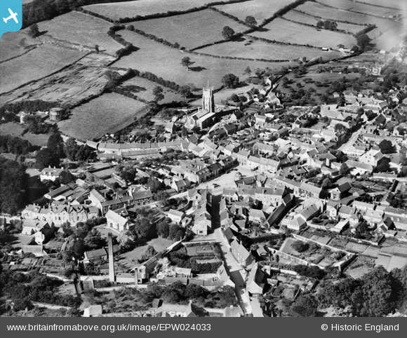
EPW024033 ENGLAND (1928). St Mary's Church and the town centre, Beaminster, 1928
© Copyright OpenStreetMap contributors and licensed by the OpenStreetMap Foundation. 2025. Cartography is licensed as CC BY-SA.
Nearby Images (17)
EPW024033

EPW013512

EPW013513

EPW024036

EPW054802

EPW013514

EPW054803

EPW024035

EPW024034

EPW024031

EPW024038

EPW054799

EPW054801

EPW054798

EPW054796

EPW054800

EPW024039

Details
| Title | [EPW024033] St Mary's Church and the town centre, Beaminster, 1928 |
| Reference | EPW024033 |
| Date | September-1928 |
| Link | |
| Place name | BEAMINSTER |
| Parish | BEAMINSTER |
| District | |
| Country | ENGLAND |
| Easting / Northing | 347995, 101269 |
| Longitude / Latitude | -2.7381669045034, 50.808074125812 |
| National Grid Reference | ST480013 |