
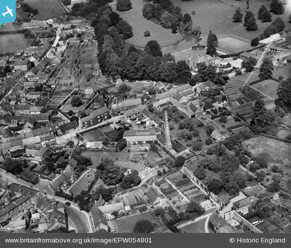
EPW054801 ENGLAND (1937). The Cow and Gate Milk Factory and environs, Beaminster, 1937
© Copyright OpenStreetMap contributors and licensed by the OpenStreetMap Foundation. 2025. Cartography is licensed as CC BY-SA.
Nearby Images (16)
EPW054801

EPW054799

EPW054796

EPW054800

EPW054798

EPW024038

EPW024031

EPW024039

EPW054802

EPW013514

EPW024036

EPW013512

EPW013513

EPW024033

EPW054803

EPW024035

Details
| Title | [EPW054801] The Cow and Gate Milk Factory and environs, Beaminster, 1937 |
| Reference | EPW054801 |
| Date | August-1937 |
| Link | |
| Place name | BEAMINSTER |
| Parish | BEAMINSTER |
| District | |
| Country | ENGLAND |
| Easting / Northing | 348182, 101321 |
| Longitude / Latitude | -2.7355201752542, 50.80855851529 |
| National Grid Reference | ST482013 |


