
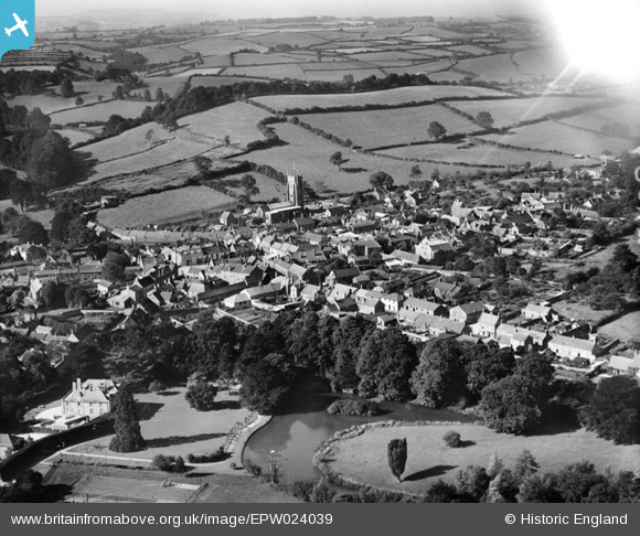
EPW024039 ENGLAND (1928). The town centre, Beaminster, from the north-east, 1928
© Copyright OpenStreetMap contributors and licensed by the OpenStreetMap Foundation. 2025. Cartography is licensed as CC BY-SA.
Nearby Images (15)
EPW024039

EPW054801

EPW054799

EPW024038

EPW054800

EPW054796

EPW024031

EPW054798

EPW013514

EPW024036

EPW054802

EPW054803

EPW013512

EPW013513

EPW024033

Details
| Title | [EPW024039] The town centre, Beaminster, from the north-east, 1928 |
| Reference | EPW024039 |
| Date | September-1928 |
| Link | |
| Place name | BEAMINSTER |
| Parish | BEAMINSTER |
| District | |
| Country | ENGLAND |
| Easting / Northing | 348187, 101467 |
| Longitude / Latitude | -2.7354698268536, 50.809871915775 |
| National Grid Reference | ST482015 |
Pins
Be the first to add a comment to this image!
User Comment Contributions
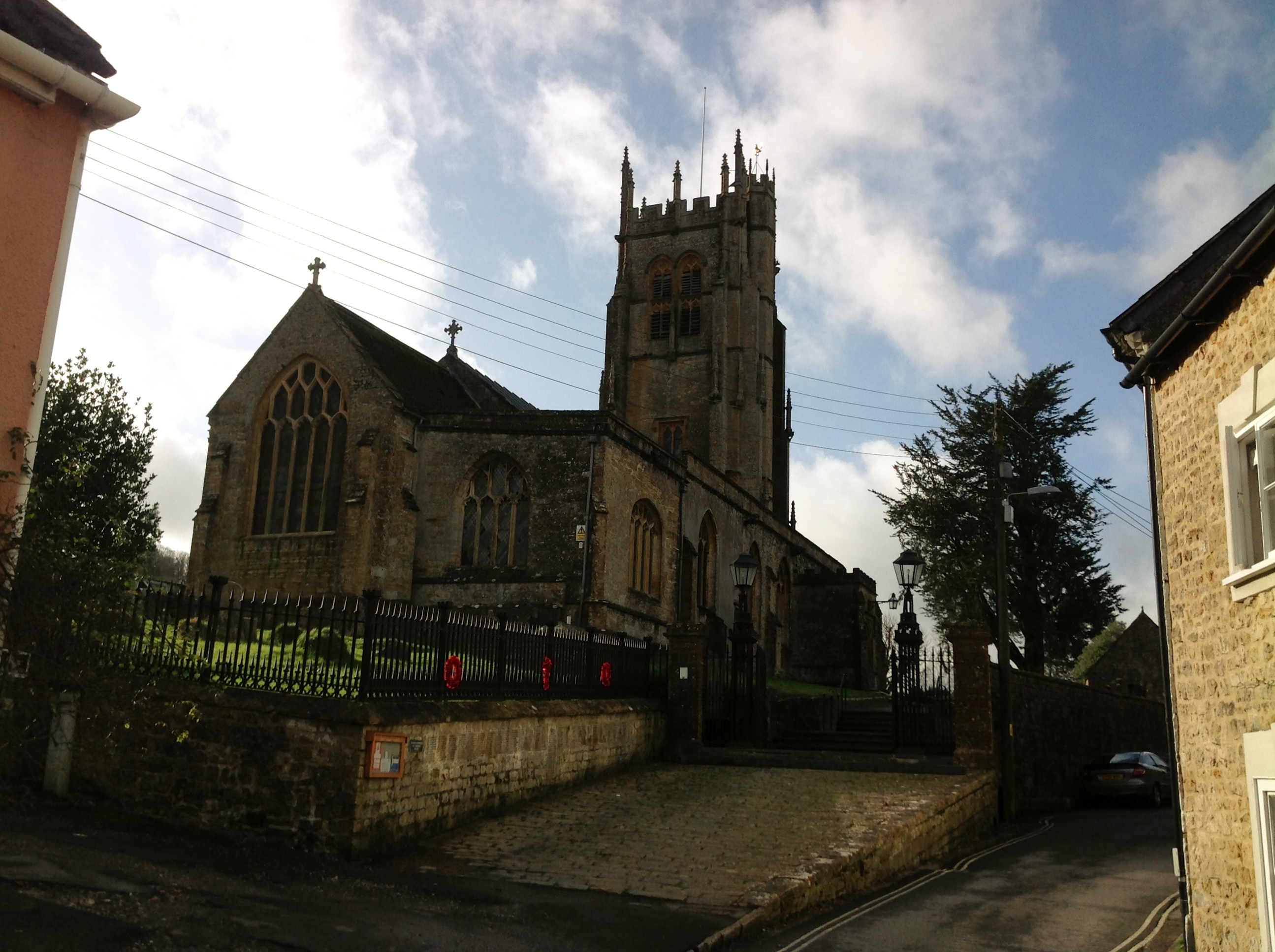
St. Mary's Church 01/02/2014 |

Class31 |
Sunday 2nd of February 2014 04:43:21 PM |