
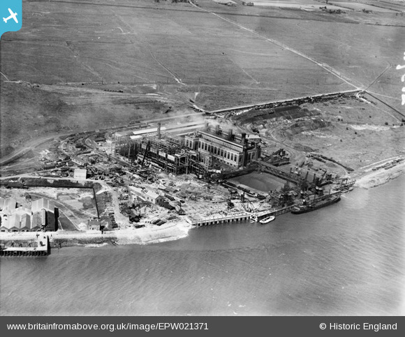
EPW021371 ENGLAND (1928). Barking Power Station under construction, Creekmouth, 1928
© Copyright OpenStreetMap contributors and licensed by the OpenStreetMap Foundation. 2026. Cartography is licensed as CC BY-SA.
Nearby Images (40)
EPW021371

EPW010667

EPW032829

EPW008726

EPW010661

EPW008727

EPW032828

EPW009689

EPW009686

EPW010665

EPW008725

EPW009685

EPW009687

EPW010668

EPW008729

EPW009688

EPW010670

EPW009690

EPW010671

EPW008728

EPW009666

EPW009691

EPW009692

EPW010663

EPW010662

EPW010666

EPW012739

EPW012743

EAW001441

EAW045748

EPW036789

EAW045746

EPW010664

EAW045749

EAW045747

EAW045744

EAW045743

EAW045750

EAW045745

EPW012740

Details
| Title | [EPW021371] Barking Power Station under construction, Creekmouth, 1928 |
| Reference | EPW021371 |
| Date | 30-May-1928 |
| Link | |
| Place name | CREEKMOUTH |
| Parish | |
| District | |
| Country | ENGLAND |
| Easting / Northing | 546412, 181701 |
| Longitude / Latitude | 0.11028679503177, 51.514752159845 |
| National Grid Reference | TQ464817 |
Pins
User Comment Contributions
It would be more correct to say "under expansion", seeing that the chimneys in the completed building are smoking. Barking A power station was opened 19th May 1925. 1928 seems a bit early for the start of Barking B, fully operational in 1939. |

grahamj42 |
Tuesday 26th of June 2012 07:34:46 PM |