
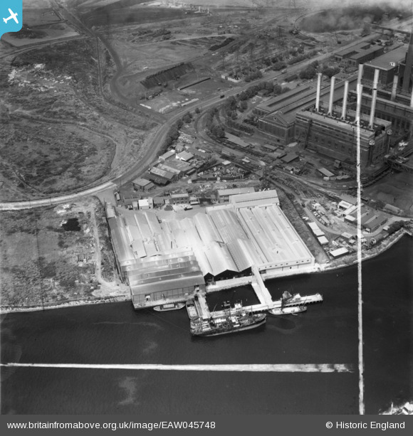
EAW045748 ENGLAND (1952). De Pass Fertilizers Ltd Factory and part of the adjacent Power Station, Creekmouth, 1952. This image was marked by Aerofilms Ltd for photo editing.
© Copyright OpenStreetMap contributors and licensed by the OpenStreetMap Foundation. 2026. Cartography is licensed as CC BY-SA.
Nearby Images (33)
EAW045748

EAW045746

EAW045747

EAW045744

EAW045743

EAW045750

EAW045749

EAW045745

EPW008728

EPW010670

EPW010671

EPW009666

EPW008729

EPW008725

EPW032829

EPW010663

EPW008726

EPW021371

EPW036779

EPW010667

EPW009690

EPW008727

EPW009689

EPW010661

EPW010668

EPW032828

EPW009685

EPW009688

EPW009687

EPW009686

EPW010664

EPW009692

EPW010666

Details
| Title | [EAW045748] De Pass Fertilizers Ltd Factory and part of the adjacent Power Station, Creekmouth, 1952. This image was marked by Aerofilms Ltd for photo editing. |
| Reference | EAW045748 |
| Date | 6-August-1952 |
| Link | |
| Place name | CREEKMOUTH |
| Parish | |
| District | |
| Country | ENGLAND |
| Easting / Northing | 546222, 181667 |
| Longitude / Latitude | 0.10753614740504, 51.514495838375 |
| National Grid Reference | TQ462817 |
Pins
Be the first to add a comment to this image!