
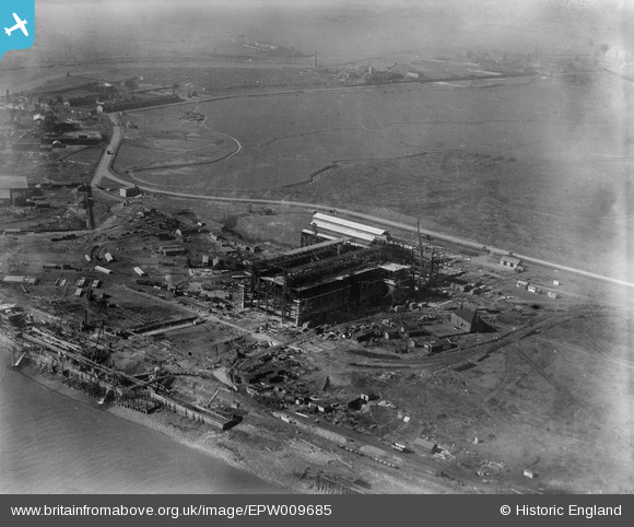
EPW009685 ENGLAND (1923). Barking Power Station under construction, Creekmouth, 1923
© Copyright OpenStreetMap contributors and licensed by the OpenStreetMap Foundation. 2026. Cartography is licensed as CC BY-SA.
Nearby Images (35)
EPW009685

EPW009688

EPW032828

EPW009687

EPW009689

EPW009686

EPW010661

EPW009691

EPW009692

EPW010667

EPW009690

EPW010665

EPW021371

EPW010666

EPW012743

EAW001441

EPW012739

EPW010662

EPW008725

EPW008727

EPW032829

EPW010668

EPW008726

EPW010671

EPW009666

EPW010670

EPW008728

EPW008729

EPW010663

EPW036789

EPW012740

EAW045748

EPW010669

EPW012742

EAW045749

Details
| Title | [EPW009685] Barking Power Station under construction, Creekmouth, 1923 |
| Reference | EPW009685 |
| Date | 1923 |
| Link | |
| Place name | CREEKMOUTH |
| Parish | |
| District | |
| Country | ENGLAND |
| Easting / Northing | 546454, 181758 |
| Longitude / Latitude | 0.11091540025867, 51.515253495322 |
| National Grid Reference | TQ465818 |
Pins
Be the first to add a comment to this image!