
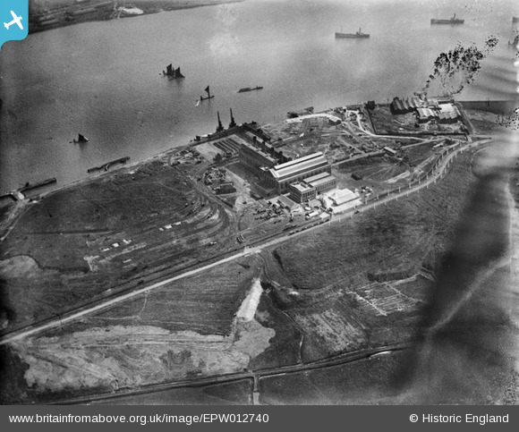
EPW012740 ENGLAND (1925). Barking Power Station, Creekmouth, 1925
© Copyright OpenStreetMap contributors and licensed by the OpenStreetMap Foundation. 2026. Cartography is licensed as CC BY-SA.
Nearby Images (25)
EPW012740

EPW012742

EAW001441

EPW012743

EPW012739

EPW036789

EPW010666

EPW009692

EPW009691

EPW009688

EPW010662

EPW009685

EPW009687

EPW009686

EPW032828

EPW009689

EPW010661

EPW009690

EPW010665

EPW010667

EPW021371

EPW008725

EPW010671

EPW032829

EPW010670

Details
| Title | [EPW012740] Barking Power Station, Creekmouth, 1925 |
| Reference | EPW012740 |
| Date | April-1925 |
| Link | |
| Place name | CREEKMOUTH |
| Parish | |
| District | |
| Country | ENGLAND |
| Easting / Northing | 546584, 181914 |
| Longitude / Latitude | 0.11285267346764, 51.516621646848 |
| National Grid Reference | TQ466819 |
Pins

rac |
Thursday 13th of September 2018 08:51:50 PM | |
|
rac |
Thursday 13th of September 2018 08:50:37 PM | |
|
rac |
Thursday 13th of September 2018 08:49:27 PM | |
|
rac |
Thursday 13th of September 2018 08:48:47 PM | |
|
rac |
Thursday 13th of September 2018 08:47:36 PM |