
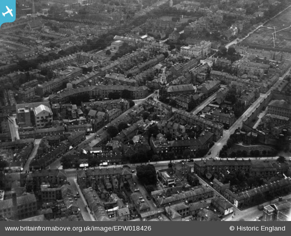
EPW018426 ENGLAND (1927). Holy Trinity Church and surrounding streets, Leicester, 1927. This image has been produced from a print.
© Copyright OpenStreetMap contributors and licensed by the OpenStreetMap Foundation. 2026. Cartography is licensed as CC BY-SA.
Nearby Images (6)
EPW018426

EAW051829

EPW015282

EPW015279

EPW015281

EPW015280

Details
| Title | [EPW018426] Holy Trinity Church and surrounding streets, Leicester, 1927. This image has been produced from a print. |
| Reference | EPW018426 |
| Date | 10-June-1927 |
| Link | |
| Place name | LEICESTER |
| Parish | |
| District | |
| Country | ENGLAND |
| Easting / Northing | 458878, 303798 |
| Longitude / Latitude | -1.1300269259922, 52.628390394311 |
| National Grid Reference | SK589038 |
Pins

Gordon |
Wednesday 25th of January 2017 07:36:47 PM | |
|
Jim Mitcho |
Friday 13th of February 2015 05:56:12 PM | |
|
Jim Mitcho |
Friday 13th of February 2015 05:55:35 PM | |
|
Jim Mitcho |
Friday 13th of February 2015 05:54:38 PM | |
|
Jim Mitcho |
Friday 13th of February 2015 05:53:59 PM |