
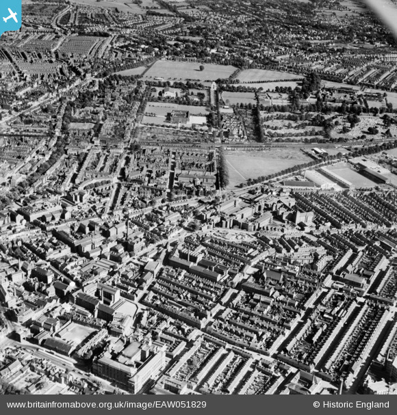
EAW051829 ENGLAND (1953). HM Prison on Welford Road, Leicester Royal Infirmary and environs, Leicester, 1953
© Copyright OpenStreetMap contributors and licensed by the OpenStreetMap Foundation. 2026. Cartography is licensed as CC BY-SA.
Nearby Images (6)
EAW051829

EPW015279

EPW015282

EPW015281

EPW015280

EPW018426

Details
| Title | [EAW051829] HM Prison on Welford Road, Leicester Royal Infirmary and environs, Leicester, 1953 |
| Reference | EAW051829 |
| Date | 1-September-1953 |
| Link | |
| Place name | LEICESTER |
| Parish | |
| District | |
| Country | ENGLAND |
| Easting / Northing | 458797, 303670 |
| Longitude / Latitude | -1.1312464097417, 52.627248487909 |
| National Grid Reference | SK588037 |
Pins

John W |
Friday 16th of December 2016 09:04:42 PM | |
|
Jim Mitcho |
Friday 13th of February 2015 06:16:49 PM | |
|
Jim Mitcho |
Friday 13th of February 2015 06:14:05 PM | |
|
Jim Mitcho |
Friday 13th of February 2015 06:13:10 PM | |
|
Jim Mitcho |
Friday 13th of February 2015 06:12:29 PM | |
|
Jim Mitcho |
Friday 13th of February 2015 06:11:00 PM |