
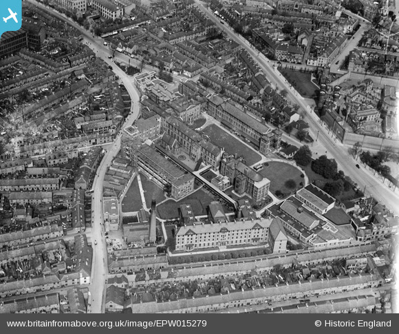
EPW015279 ENGLAND (1926). The Leicester Royal Infirmary, Leicester, 1926
© Copyright OpenStreetMap contributors and licensed by the OpenStreetMap Foundation. 2026. Cartography is licensed as CC BY-SA.
Nearby Images (6)
EPW015279

EPW015282

EPW015280

EPW015281

EAW051829

EPW018426

Details
| Title | [EPW015279] The Leicester Royal Infirmary, Leicester, 1926 |
| Reference | EPW015279 |
| Date | 20-April-1926 |
| Link | |
| Place name | LEICESTER |
| Parish | |
| District | |
| Country | ENGLAND |
| Easting / Northing | 458685, 303625 |
| Longitude / Latitude | -1.1329090525996, 52.626856070732 |
| National Grid Reference | SK587036 |
Pins

mike |
Monday 30th of January 2023 09:37:56 PM | |
|
Jim Mitcho |
Friday 13th of February 2015 06:08:02 PM | |
|
Jim Mitcho |
Friday 13th of February 2015 06:05:59 PM | |
|
deeb |
Sunday 9th of December 2012 01:49:26 PM |
User Comment Contributions
It is worth comparing this view with the current Google Maps image to see the extent of destruction caused to the surrounding area by the expansion of the LRI. http://goo.gl/maps/S3rHH |
Dougal the Dog |
Sunday 21st of October 2012 10:55:04 AM |