
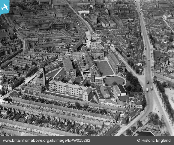
EPW015282 ENGLAND (1926). The Leicester Royal Infirmary, Leicester, 1926
© Copyright OpenStreetMap contributors and licensed by the OpenStreetMap Foundation. 2026. Cartography is licensed as CC BY-SA.
Nearby Images (6)
EPW015282

EPW015279

EPW015280

EPW015281

EAW051829

EPW018426

Details
| Title | [EPW015282] The Leicester Royal Infirmary, Leicester, 1926 |
| Reference | EPW015282 |
| Date | 20-April-1926 |
| Link | |
| Place name | LEICESTER |
| Parish | |
| District | |
| Country | ENGLAND |
| Easting / Northing | 458685, 303626 |
| Longitude / Latitude | -1.1329088749102, 52.626865060486 |
| National Grid Reference | SK587036 |
Pins

John W |
Friday 16th of December 2016 09:03:10 PM | |
|
stex |
Friday 6th of June 2014 04:05:35 PM | |
|
Underwood55 |
Tuesday 11th of December 2012 08:29:56 PM |