
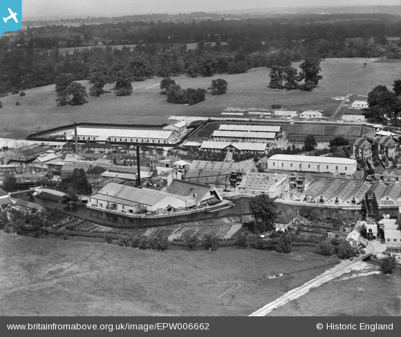
EPW006662 ENGLAND (1921). View of Bells United Asbestos Works, Maple Cross, from the west, 1921
© Copyright OpenStreetMap contributors and licensed by the OpenStreetMap Foundation. 2026. Cartography is licensed as CC BY-SA.
Nearby Images (28)
EPW006662

EPW006656

EPW006660

EPW006654

EPW006653

EPW056355

EPW006657

EPW056349

EPW006664

EPW006659

EPW056356

EPW056357

EPW006652

EPW006658

EPW006655

EPW057661

EPW056348

EPW057662

EPW056350

EPW006203

EPW056353

EPW006668

EPW057663

EPW056351

EPW006663

EPW006667

EPW056354

EPW056352

Details
| Title | [EPW006662] View of Bells United Asbestos Works, Maple Cross, from the west, 1921 |
| Reference | EPW006662 |
| Date | June-1921 |
| Link | |
| Place name | MAPLE CROSS |
| Parish | |
| District | |
| Country | ENGLAND |
| Easting / Northing | 503995, 191030 |
| Longitude / Latitude | -0.49805188790857, 51.60801735228 |
| National Grid Reference | TQ040910 |
Pins
Be the first to add a comment to this image!