
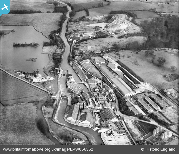
EPW056352 ENGLAND (1938). Harefield Mills on the Grand Union Canal, Harefield, 1938
© Copyright OpenStreetMap contributors and licensed by the OpenStreetMap Foundation. 2026. Cartography is licensed as CC BY-SA.
Nearby Images (23)
EPW056352

EPW056351

EPW006661

EPW057663

EPW056354

EPW056353

EPW056350

EPW056348

EPW006658

EPW006663

EPW057661

EPW057662

EPW006667

EPW006652

EPW006668

EPW056349

EPW006657

EPW056355

EPW006659

EPW006654

EPW006664

EPW006660

EPW006662

Details
| Title | [EPW056352] Harefield Mills on the Grand Union Canal, Harefield, 1938 |
| Reference | EPW056352 |
| Date | 5-February-1938 |
| Link | |
| Place name | HAREFIELD |
| Parish | |
| District | |
| Country | ENGLAND |
| Easting / Northing | 504140, 191269 |
| Longitude / Latitude | -0.49588748845131, 51.610138974947 |
| National Grid Reference | TQ041913 |
Pins
Be the first to add a comment to this image!