
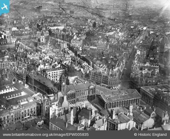
EPW005835 ENGLAND (1921). The Town Hall, New Street and environs, Birmingham, 1921. This image has been produced from a print.
© Copyright OpenStreetMap contributors and licensed by the OpenStreetMap Foundation. 2026. Cartography is licensed as CC BY-SA.
Nearby Images (40)
EPW005835

EAW001234

EPW005853

EPW037053

EPW037056

EPW005843

EAW013566

EPW005845

EPW005851

EPW057480

EPW005836

EAW001236

EPW005839

EPW005854

EAW006930

EPW005849

EPW022584

EAW001239

EPW022588

EAW015327

EPW005850

EPW053091

EPW022585

EAW035107

EAW001235

EAW026251

EAW013563

EAW029415

EAW035108

EAW013564

EPW001136

EAW026253

EAW029414

EPW005842

EAW001237

EPW005840

EPW038601

EPW022586

EPW058129

EPW054234

Details
| Title | [EPW005835] The Town Hall, New Street and environs, Birmingham, 1921. This image has been produced from a print. |
| Reference | EPW005835 |
| Date | March-1921 |
| Link | |
| Place name | BIRMINGHAM |
| Parish | |
| District | |
| Country | ENGLAND |
| Easting / Northing | 406778, 286908 |
| Longitude / Latitude | -1.900188212276, 52.479686082597 |
| National Grid Reference | SP068869 |
Pins
Be the first to add a comment to this image!