
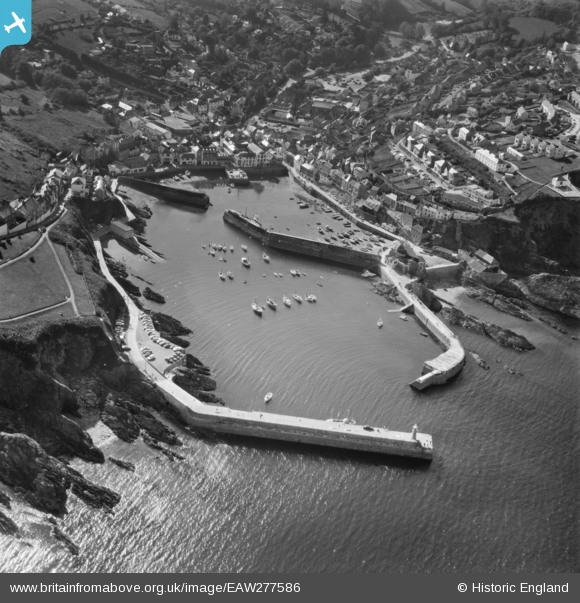
EAW277586 ENGLAND (1974). Village and harbour, Mevagissey, 1974
© Copyright OpenStreetMap contributors and licensed by the OpenStreetMap Foundation. 2026. Cartography is licensed as CC BY-SA.
Nearby Images (15)
EAW277586

EAW051336

EPW021707

EAW051334

EAW051337

EPW021705

EPW021708

EAW051333

EPW021706

EAW021377

EAW040863

EAW051332

EAW053026

EAW131420

EAW051335

Details
| Title | [EAW277586] Village and harbour, Mevagissey, 1974 |
| Reference | EAW277586 |
| Date | 12-June-1974 |
| Link | |
| Place name | MEVAGISSEY |
| Parish | MEVAGISSEY |
| District | |
| Country | ENGLAND |
| Easting / Northing | 201661, 44767 |
| Longitude / Latitude | -4.7835243948712, 50.268894831128 |
| National Grid Reference | SX017448 |
Pins

RobH |
Thursday 22nd of August 2024 12:23:13 PM |