
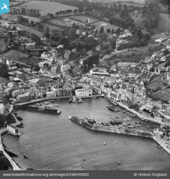
EAW040863 ENGLAND (1951). The Harbour and the village, Mevagissey, 1951
© Copyright OpenStreetMap contributors and licensed by the OpenStreetMap Foundation. 2026. Cartography is licensed as CC BY-SA.
Nearby Images (14)
EAW040863

EAW021377

EAW051332

EPW021706

EAW053026

EAW131420

EPW021707

EPW021708

EAW051334

EAW051336

EAW277586

EAW051333

EAW051337

EPW021705

Details
| Title | [EAW040863] The Harbour and the village, Mevagissey, 1951 |
| Reference | EAW040863 |
| Date | 14-October-1951 |
| Link | |
| Place name | MEVAGISSEY |
| Parish | MEVAGISSEY |
| District | |
| Country | ENGLAND |
| Easting / Northing | 201486, 44836 |
| Longitude / Latitude | -4.7860134901448, 50.26945589969 |
| National Grid Reference | SX015448 |
Pins

CornwallPhil |
Monday 16th of June 2014 10:55:45 PM |
User Comment Contributions

Mevagissey 21/04/2014 |

Class31 |
Wednesday 23rd of April 2014 06:56:17 PM |