
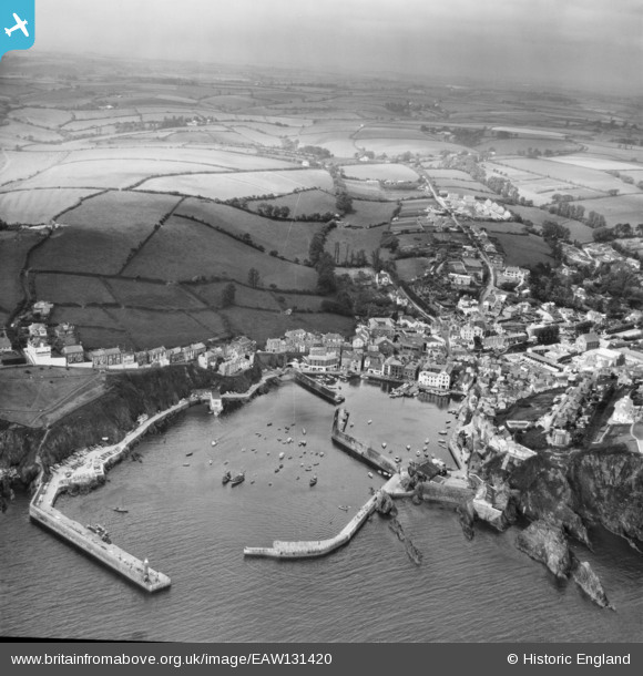
EAW131420 ENGLAND (1964). Village and harbour, Mevagissey, 1964
© Copyright OpenStreetMap contributors and licensed by the OpenStreetMap Foundation. 2026. Cartography is licensed as CC BY-SA.
Nearby Images (12)
EAW131420

EAW051332

EPW021706

EAW040863

EAW021377

EAW051334

EPW021707

EPW021708

EAW051336

EAW053026

EAW277586

EAW051338

Details
| Title | [EAW131420] Village and harbour, Mevagissey, 1964 |
| Reference | EAW131420 |
| Date | 18-June-1964 |
| Link | |
| Place name | MEVAGISSEY |
| Parish | MEVAGISSEY |
| District | |
| Country | ENGLAND |
| Easting / Northing | 201421, 44727 |
| Longitude / Latitude | -4.7868673808884, 50.268454812314 |
| National Grid Reference | SX014447 |
Pins
Be the first to add a comment to this image!