
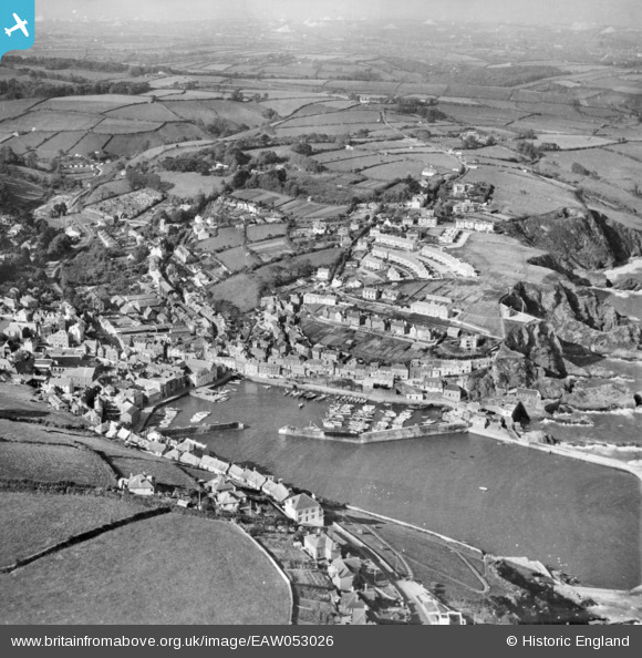
EAW053026 ENGLAND (1953). The village and harbour, Mevagissey, 1953
© Copyright OpenStreetMap contributors and licensed by the OpenStreetMap Foundation. 2026. Cartography is licensed as CC BY-SA.
Nearby Images (14)
EAW053026

EAW021377

EAW040863

EPW021708

EAW051332

EAW051333

EPW021707

EPW021706

EAW051334

EAW051336

EAW277586

EAW131420

EAW051337

EPW021705

Details
| Title | [EAW053026] The village and harbour, Mevagissey, 1953 |
| Reference | EAW053026 |
| Date | 19-November-1953 |
| Link | |
| Place name | MEVAGISSEY |
| Parish | MEVAGISSEY |
| District | |
| Country | ENGLAND |
| Easting / Northing | 201542, 44937 |
| Longitude / Latitude | -4.7852815217756, 50.270382085932 |
| National Grid Reference | SX015449 |
Pins

redmist |
Sunday 6th of November 2022 04:50:01 PM |