
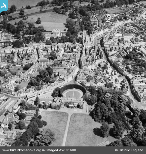
EAW031680 ENGLAND (1950). Cirencester Park, St John the Baptist's Church and the town centre, Cirencester, 1950
© Copyright OpenStreetMap contributors and licensed by the OpenStreetMap Foundation. 2026. Cartography is licensed as CC BY-SA.
Nearby Images (19)
EAW031680

EAW015789

EAW031677

EAW015788

EPW022407

EAW015790

EPW022412

EAW031679

EPW022416

EPW022410

EPW006310

EAW031681

EPW061776

EPW061775

EAW006877

EPW022413

EPW022408

EPW061780

EPW037748

Details
| Title | [EAW031680] Cirencester Park, St John the Baptist's Church and the town centre, Cirencester, 1950 |
| Reference | EAW031680 |
| Date | 3-August-1950 |
| Link | |
| Place name | CIRENCESTER |
| Parish | CIRENCESTER |
| District | |
| Country | ENGLAND |
| Easting / Northing | 402114, 202059 |
| Longitude / Latitude | -1.9693961491007, 51.716796736718 |
| National Grid Reference | SP021021 |
Pins

Alan McFaden |
Wednesday 21st of May 2014 09:30:44 PM | |
|
Alan McFaden |
Wednesday 21st of May 2014 09:29:36 PM |

