
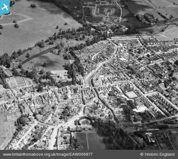
EAW006877 ENGLAND (1947). The town centre, Cirencester, 1947
© Copyright OpenStreetMap contributors and licensed by the OpenStreetMap Foundation. 2026. Cartography is licensed as CC BY-SA.
Nearby Images (19)
EAW006877

EPW022413

EPW022417

EAW031681

EPW022410

EPW022416

EPW006310

EPW022412

EPW022415

EPW061780

EPW061776

EPW061775

EPW022407

EAW031677

EAW006878

EAW031680

EPW061778

EPW061779

EPW022408

Details
| Title | [EAW006877] The town centre, Cirencester, 1947 |
| Reference | EAW006877 |
| Date | 10-June-1947 |
| Link | |
| Place name | CIRENCESTER |
| Parish | CIRENCESTER |
| District | |
| Country | ENGLAND |
| Easting / Northing | 402357, 202062 |
| Longitude / Latitude | -1.9658782790253, 51.716822744422 |
| National Grid Reference | SP024021 |
Pins

Alan McFaden |
Wednesday 21st of May 2014 09:57:20 PM | |
|
Alan McFaden |
Wednesday 21st of May 2014 09:56:52 PM | |
|
Alan McFaden |
Wednesday 21st of May 2014 09:56:05 PM |


