
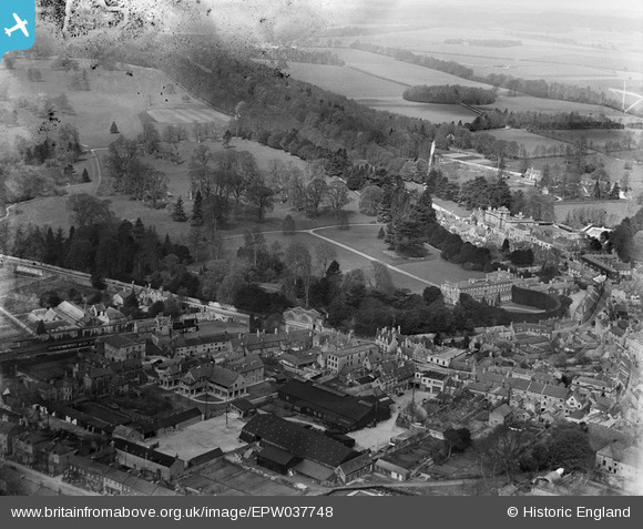
EPW037748 ENGLAND (1932). Cirencester Park and the town, Cirencester, 1932
© Copyright OpenStreetMap contributors and licensed by the OpenStreetMap Foundation. 2026. Cartography is licensed as CC BY-SA.
Nearby Images (8)
EPW037748

EPW037747

EAW015790

EAW015788

EAW015789

EAW031679

EAW015787

EAW031680

Details
| Title | [EPW037748] Cirencester Park and the town, Cirencester, 1932 |
| Reference | EPW037748 |
| Date | May-1932 |
| Link | |
| Place name | CIRENCESTER |
| Parish | CIRENCESTER |
| District | |
| Country | ENGLAND |
| Easting / Northing | 401868, 201984 |
| Longitude / Latitude | -1.9729578315573, 51.716123197191 |
| National Grid Reference | SP019020 |
Pins

Helene Barrott |
Friday 3rd of January 2014 11:11:00 PM | |
Robert Tims |
Friday 13th of September 2013 02:40:54 PM | |
|
GLOMR7 |
Thursday 27th of December 2012 11:41:56 PM |